Cowardin: PEM1C, PFO1C, PFO1A, PEM1A.
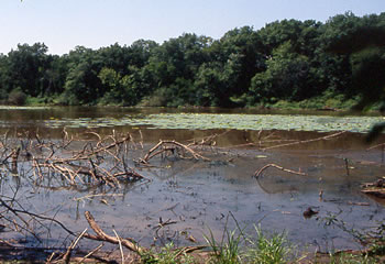
Location. This reference wetland is on a portion of the river systems like the Deep Fork River where floods have created new river channels, cutting off the original channel. The cut off channels are most often on bends, giving the wetland a characteristic oxbow or horseshoe shape. Most of the oxbows in the Deep Fork system are less than 3 feet in depth and are sometimes dry in late summer. These wetlands are generally stable, but sediment loading from large flood events may decrease their overall depth. The wetland ranges in size from 10 acres to over 100 acres.
Land Form Ecoregion: Central Oklahoma/Texas Plains (29). MLRA: Western Coastal Plains (118B).