Cowardin: PFO1A, PFO1C, PEM1A.
Location. This reference wetland is a portion of the Little River stream system. It is located on the east side of the Little River National Wildlife Refuge. Latitude: 33° 57' 44". Longitude: 94° 37' 36". Legal: Sec 7 T7S R26E.
Landform. Ecoregion: Central Oklahoma/Texas Plains (29). MLRA: Western Coastal Plains (133B).
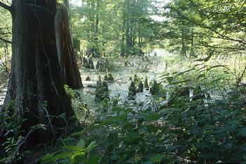
General Description. This reference site represents wetlands that border the Little River stream system in McCurtain County. This wetland landform is characterized by long and narrow depressions in broad flood plains and whose origin can be traced to abandoned stream channels. Surface water accumulation is from out-of-bank flooding and/or runoff from adjacent areas. Sediment loading is limited to large flood events. Groundwater tables are 1 to 3 feet above the surface during the winter and early spring. These wetlands range in size from 2 to 80 acres.