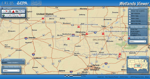
 View details on this or other wetlands area using the map viewer. It has a
number of tools that will allow you to explore wetlands in more detail:
View details on this or other wetlands area using the map viewer. It has a
number of tools that will allow you to explore wetlands in more detail:
- Zoom in/out
- Turn on/off layers
- Identify features
- Measure distances
- Query data
- Buffer features
- Select by: line or polygon
The map viewer will dynamically update the map as you zoom in or out and turn map layers on or off. For example, you can turn on an aerial orthophoto as the background layer and display a layer showing the NWI wetland boundaries on top of it. Then use the identify tool to find the Cowardin System Code that describe various wetland types displayed.